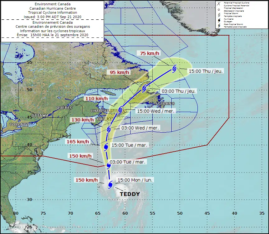
Environment Canada meteorologist Bob Robichaud says Hurricane Teddy is going to pass through or near Guysborough, Antigonish, Richmond, and Inverness counties as a post-tropical storm.
He says they expect it to come ashore somewhere between Halifax and eastern Cape Breton, with a leading front landing Tuesday afternoon, followed by a brief break early Wednesday, and the core of the storm making landfall Wednesday afternoon.
Robichaud says just because Teddy will likely be downgraded to a post-tropical storm before it hits doesn’t mean it won’t be a powerful storm.
“With a track going up the Eastern Shore, Cape Breton would be within that area where there could be some damaging winds.”
Robichaud says storm surges and potential coastal flooding along the whole of the Atlantic coast will be the first signs of Teddy’s arrival.
He says the worst of the wind will be on the east side of the storm’s path, up to 100 km/h, with the worst rain coming on the west side, as much as 50-100 mm.
Robichaud says Teddy is a very different storm to 2019’s Hurricane Dorian.
“We’re not going to see the damage over quite that large an area with Teddy.”
He says Teddy will be much more focused on it’s path through the Quad Counties.