A winter storm is expected to bring significant snowfall and strong winds to Nova Scotia, according to Environment Canada.
The agency issued yellow‑level alerts on Sunday, warning of hazardous winter weather from Sunday evening through Tuesday.
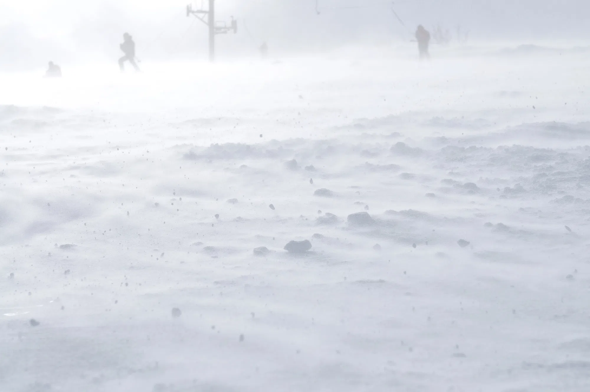
Environment Canada said snowfall totals could range from 20 to 35 centimetres across the province, with stronger winds and blowing snow along exposed coastal areas.
Eastern Nova Scotia
Environment Canada said eastern parts of the province can expect 20 to 30 centimetres of snow or more, beginning overnight Sunday and continuing until Tuesday afternoon.
Winds may gust up to 70 kilometres an hour along the Atlantic Coast, which the agency said could lead to blowing snow and reduced visibility.
Environment Canada said travel will likely be challenging, especially during the Monday morning commute.
The agency also has a snow squall warning in effect for some eastern communities.
Environment Canada said persistent snow squalls are producing sudden drops in visibility and rapid snow accumulation, with up to five additional centimetres possible.
Northwesterly wind gusts reaching 60 kilometres per hour may reduce visibility to nearly zero at times.
The agency noted that travel conditions can quickly change and deteriorate under these conditions.
Central Nova Scotia
A snowfall warning is in effect for central parts of the province, where Environment Canada expects 25 to 35 centimetres of snow.
The agency said the storm will begin later Sunday evening and taper off early Tuesday morning.
The heaviest snowfall is expected overnight and into Monday morning.
Environment Canada said winds could gust between 50 and 70 kilometres an hour along the Atlantic Coast, leading to blowing snow and reduced visibility.
Travel conditions may deteriorate quickly, and accumulating snow will likely make roads and walkways difficult to navigate.
Halifax Transit says buses will be running on snow routes and service disruptions will be announced on social media.
Southwest Nova Scotia
Environment Canada said southwest Nova Scotia is expected to receive 25 to 35 centimetres of snow, beginning Sunday evening and tapering off early Tuesday.
The agency said the heaviest snow is expected overnight and into early Monday morning.
Northeasterly wind gusts between 60 and 80 kilometres an hour are forecast, which Environment Canada said could reduce visibility to near zero in blowing snow.
Roads and walkways will likely be difficult to navigate, and the agency is advising people to postpone non‑essential travel until conditions improve.
Northern Nova Scotia
Northern parts of the province are under alerts for both snowfall and very cold wind chills.
Environment Canada said some northern communities could see up to 30 centimetres of snow, along with strong winds that may reduce visibility in blowing snow.
The agency also has a cold alert in place for the region, with wind chills between –30 and –34 degrees Celsius expected through Sunday morning.
Environment Canada said extreme cold poses a risk to everyone and advised people to dress in layers, with a wind‑resistant outer layer.
More information on staying safe in cold weather is available through the Nova Scotia Department of Health and Wellness.
Travel
If you are planning on catching a flight, the Halifax airport says they expect disruptions and beginning Sunday night into Monday morning.
In a post on social media, Halifax Stanfield says, many airlines waiving change fees.
The flight status board on the airport’s website shows a slew of cancelled flights.
School Closures
As of Sunday night, some school closures have already started.
Nova Scotia Community College (NSCC): Akerley, Pictou, Lunenburg, Ivany, Shelburne, Truro, Burridge and Institute of Technology Campus